AMITIAE - Sunday 31 March 2013


Navigating Bangkok by Bus: Web and Apps - Good, Fair and Not so Good


apple and chopsticks


advertisement


By Graham K. Rogers


Buses


When I first arrived in Bangkok, the main forms of public transport were limited to the buses, and taxis with no meters. Transportation systems have expanded greatly with new suburban rail systems, other alternatives to buses, and taxis with meters, although some taxi drivers think the meters (and stopping for passengers) are options. The backbone of the system, however, remains the Bangkok bus with over 200 routes.


Some of the people I know who claim to be in touch with what goes on in Bangkok, only use taxis or private cars. Yet the buses, slow as they are (perhaps because of the numbers of private cars in the city), are a core part of public transport systems around the city, even as the suburban railways expand. It will be a long time (if ever) before the railway systems can replace road transport, but where the systems are in place, the public flock to the trains which are packed for most of each day.

When I first came to Bangkok, I found maps that had many of the routes indicated on them. Bus routes change, roads are built, maps need updating - Maps apps from Apple and Google are no exception here - and using a map in the street sometimes brings the wrong attention. As we get to know the city, so the information on bus routes becomes part of our useful knowledge. Step outside our normal areas, and we need help.

Buses are also a good way for visitors to see the city. Many enjoy the greater numbers of air-conditioned routes now. I use these often, but some areas are not covered by such routes and the open buses (some with fans) are an alternative; as well as taxis of course. I sometimes use a route like the 40 as it goes through Chinatown and a rear seat makes a good platform from which to take photographs. Part of the ease of getting around comes with a knowledge of the city and the bus routes are a part of that.
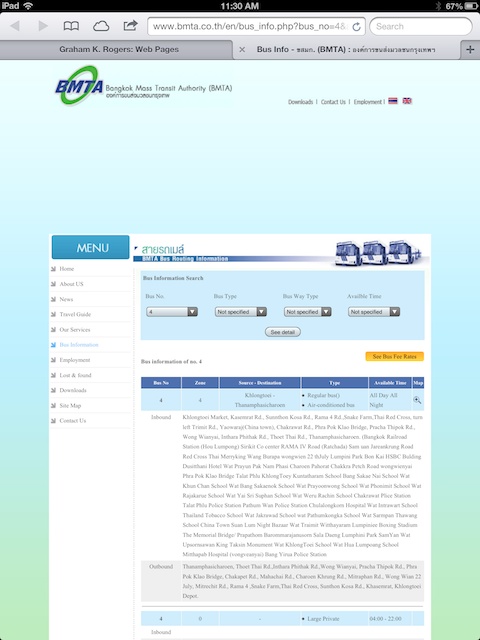
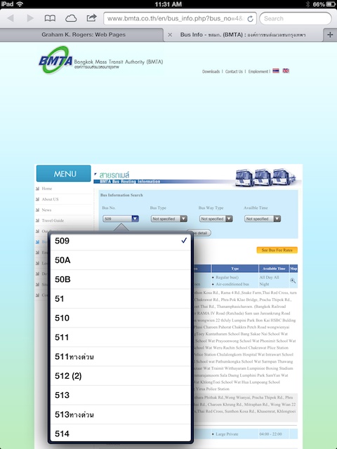

BMTA Access

A few months ago I moved to a different part of the city and trying to find out about transportation in this part of Bangkok, came across a website run by the BMTA (Bangkok Mass Transit Authority). The site is in English and Thai. it provides information on buses, but from the top level it is not easy to find the complete route reference. Once discovered, there is a pull down list of all the routes covered by the BMTA including those that are run by private contractors.


buses buses buses


The page that has the routes, displays quite well in Safari on the iPhone and the iPad, although different selectors are of course displayed. While some of the displays provide full route information (e.g route 4), not all bus routes have data entered (84A, 92). The site itself has a fair amount of other useful information in English.


Buses There is an app that is marked with the BMTA logo called BMTA Traffic Phone, but this compares poorly with the web pages and I am not exactly sure what it was suppposed to do.

None of the icons at the bottom of the screen caused any data to load; when one icon was pressed, another disappeared; pressing a couple of the icons changed the screen, but apart from artefacts changing, no data appeared. I did leave it for a while and went back to it an hour later, but there was no apparent change. In short, if I was going to be searching for a bus to use, I would have missed ten just trying to find out. Into the Trash with this one.
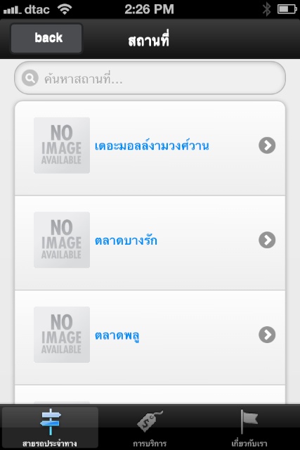

Instead, I went back to the web page on the iPhone and pressed the Export icon. That gave me several options, inlcuding "Add to Home Screen". Using that, I now have a Bus Info web app that gives me exactly what I want.


BKK-Bus

Buses Back in iTunes, a further search produced BKK-Bus. Information with the app in the iTunes App Store claims that the language is English, but do not be fooled. This app, that bears the logo of the Faculty of Information Technology at Rangsit, is solidly Thai and creaks like a wooden boat.

The app starts with a beautiful logo display, but it was all downhill from there. It opens with a series of location types, such as shopping, education, temples. These are almost self-expanatory. But the next level is a disaster.

None of the icons was available on any of these intermediary levels I tried and there was no English, only Thai. However, I was able to discern a couple, such as Central Rama 3 in the Shopping section. Tapping this reveals a list of the buses that serve the location but again, all the information is in Thai.


buses buses


The Airports section was easy as there are only two; BTS and MRTA had a list of stations, with a list of buses that passed each; there were only two Thai Railways stations shown, so this section was incomplete. The sections for police and education each had search boxes, but entering an English search term produced nothing.

The app is incomplete - perhaps it was a student project - and is not well set up for casual users: those who know, would not need such an app. It seems as if it has been developed looking through the wrong end of a telescope and does not answer the basic question, "what would users need?" This may work for those who read Thai, but not for vistors or tourists. Into the Trash with this one.
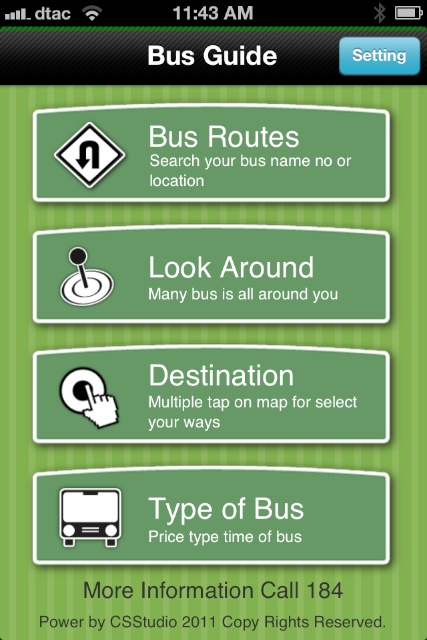
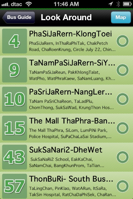
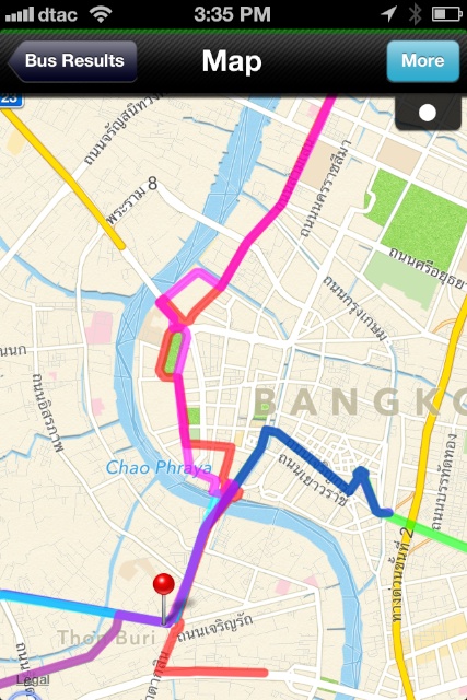

Bangkok Bus Guide

Buses The first app I downloaded may also be the best. Despite a couple of niggles, Bangkok Bus Guide works well and will actually produce the information about the buses. Particularly useful is the way it uses Location data to highlight bus routes that are nearby, although there are some shortcomings with this. A link to the Developer site takes us to a Twitter page for @imaun, nothing more.

The app has four sections: Bus Routes; Look Around; Destination; and Type of Bus. The English sub-titles with this need some editing, but the icons and the titles are clear enough. At the bottom of this first screen is the phone nunber for help (184) although my experiences with this have not been perfect in the past. At the top right of the main screen is a button for Settings. This allows a user to change settings between English and Thai (the default for me was English), to change the color of a route shown on a map (default, red) and the thickness of the route line (12).

  • Bus Routes accesses a search box in which a bus number, or a location may be entered. Searching for a location needs some refining as there are no alternative spellings offered: Trying to change Thai characters to English is not always exact as various road signs here would illustrate. For example, searching for Thalad Phlu (BTS Station name) found nothing, while other app information used "TaLadPlu". That worked in the search.

    Using the numbers option can bring up several results. For example 7 showed almost 40 routes with the number 7 in them, as well as a number of locations (such as Rama 7 Bridge). It would be easy for a user to scan through what is shown, or to refine the search.


  • Look Around asks for permission to use Location Data when first accessed, but there was nothing displayed initially. I returned to the main menu and when I tried the screen again (almost immediately) a list of several buses in the area were shown. The problem with the list is that, while several stop almost outside the Condo, a number use a road nearby and never come this way. Local knowledge, and reading some of the information displayed would help, but a tourist might be waiting for a bus that will never come.


buses buses buses


The displays of buses in Bus Routes and Look Around each have some basic route information shown to the right of the number. There is also a green circle to the left of the display. When the route information is tapped, a check mark appears here, and the Map icon at the top shows a figure depending on the number of routes checked. Tapping this shows a map of the route. The map appears to use the same data as Apple's maps app so as it is enlarged using the "pinch" so more data is shown. Adding a second bus route shows that, but in a different colour.


  • Destination is a feature that may need some refining, as well as some work by the user once data is displayed. Initially, a map (at far too high a level of zoom) is shown with the user's location. The user has to tap the screen, but I found that before a pin is placed, this action was more like press and hold. Placing a second pin and pressing Search, produced no results, so this is not a route selection feature. Instead placing one pin at a specific location, say Wongwianyai, will produce a list of routes that pass the area.

    Here I found another limitation: again something I could work round. Although 28 routes were shown for Wongwianyai, as I checked them, a notice appeared when I had reached five.


  • Type of Bus lists the seven buses operated by BMTA and shows a photograph of each, and a brief description as well as the fare or fare range. Not shown here, or in the app at all, are the yellow BMA express buses. The yellow buses that run on BMTA routes are also not shown, although details of the routes themselves are available in other sections of the app.


Comments

Buses, as good and as bad as they are here, are the backbone to public transport and things are likely to remain this way for a long time. While local knowledge - once you have it - is the best information for travelling round Bangkok (and knowing when to switch types of transport), there is a real need for easy access to data that allows those not familiar with the city (or an area within Bangkok) to find out how to move around by bus.

With sites in Thailand, one is never sure how up to date the information available is. That noted, the BMTA website gives a clear amount of information about most of the routes under its jurisdiction. Using a shortcut to make a web app may be the easiest way for most users.

For those who have the time to learn its foibles, Bangkok Bus Guide gives users a number of ways in which to search for information and, as an app for use on the street, with its location feature, may be the best way to answer the twin questions, "Where am I; and what bus will get me outta here?"

The two other apps I downloaded (BMTA Access and BKK-Bus) were a disappointment in a number of ways, and not just because of the lack of English, although with the ASEAN agreement approaching as well as the tourist industry, there is a lack of vision here. Neither of these apps seems complete; or there may be faults with data access: not something a user wants when standing at the side of the road trying to find a way home.

For all its limitations and minor faults, Bangkok Bus Guide has much potential, accepting that, like the BMTA site, data may not always be totally up to date.


Graham K. Rogers teaches at the Faculty of Engineering, Mahidol University in Thailand. He wrote in the Bangkok Post, Database supplement on IT subjects. For the last seven years of Database he wrote a column on Apple and Macs.


advertisement


Google


Made on Mac

For further information, e-mail to

information Tag information Tag

Back to eXtensions
Back to Home Page